
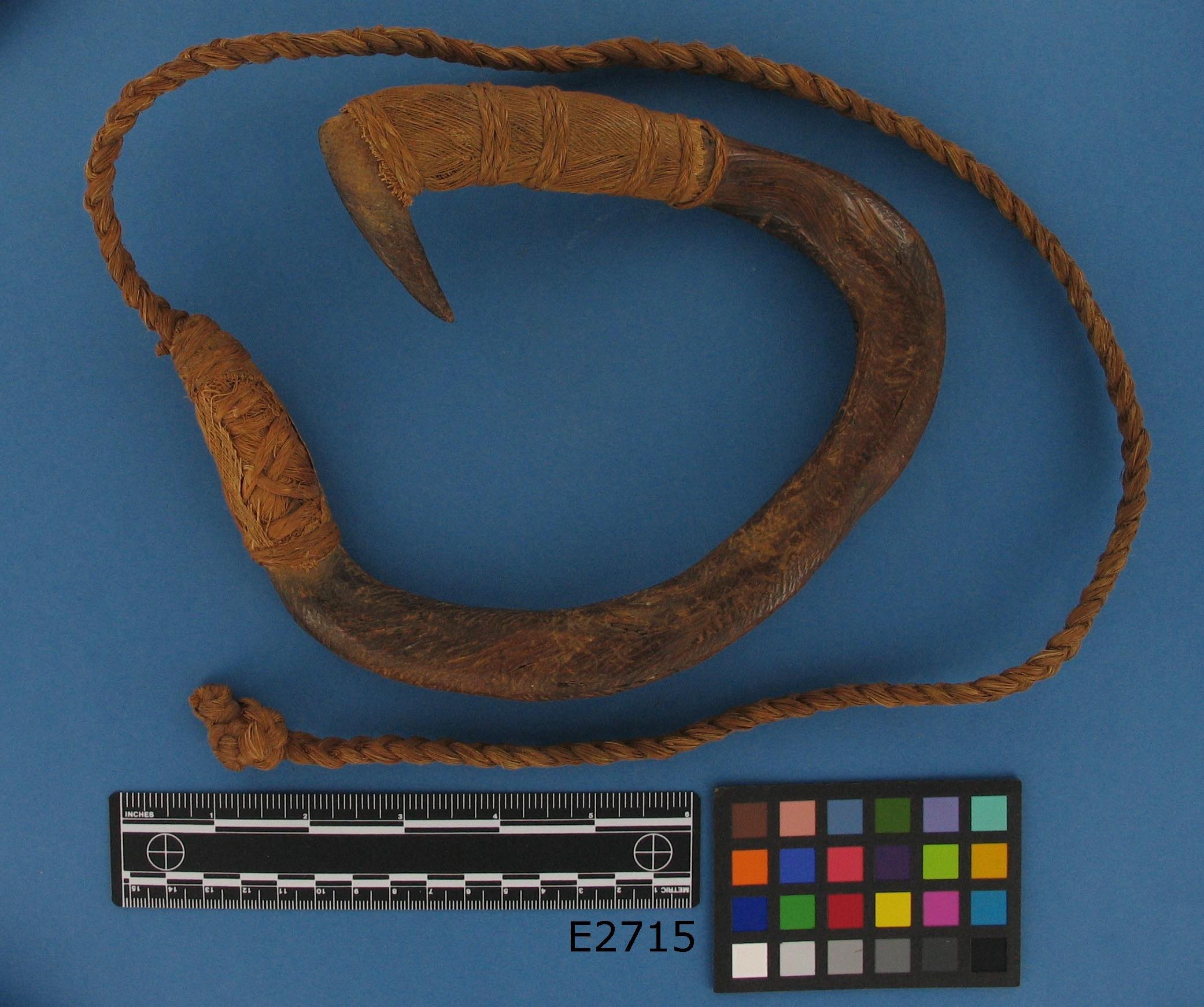
Figure 1 (above). Wooden Ruvettus (Palutupua) fishhook from Fakaofo, Tokelau, ca. 1841. (E2715, Department of Anthropology, Smithsonian Institution)
Abstract: The South Seas nation of Tokelau is officially comprised of three islands: Atafu, Nukunonu, and Fakaofo. But many people believe there is a fourth island in the group. Its indigenous name is Olohega (oloˈhɛŋa). Since 1925, Olohega (Swains) has been a U.S. territory by way of American Sāmoa and is privately owned by one family. The basis of the claim involves two American claimants, William W. Taylor and Eli Jennings.
“The Question of Olohega” is presented in two parts. Part One, published in APJJF in 2021, is an in-depth investigation of Taylor’s fraudulent claim to all four of Tokelau’s islands under the U.S. Guano Act of 1856. Part Two, presented below, is an investigation of Jennings’ claim to Olohega, with a focus on the trajectory of events and questionable statecraft that led to the island’s eventual annexation.
Keywords: Tokelau, Olohega, Guano Islands Act, Godeffroy and Son, Peruvian Slave Trade, Coconut Colonialism, U.N. Special Committee on Decolonization
Introduction
According to cartographic consensus and political institutions worldwide, Tokelau is a territory of three islands in the South Pacific: Atafu, Nukunonu, and Fakaofo. In the next few years, the three-island nation has an important decision to make. Under a U.N. decolonization scheme, Tokelau will decide as a non-self-governing territory whether to break from New Zealand or join with it (Silao 2023). One unresolved question involves a fourth island, Olohega, which many Tokelauans believe is theirs (Matagi Tokelau 1991).
Among the four islands of the Tokelau group, Olohega is the one that most resembles a colony, yet decolonization in the modern sense is not an option. The island has been a U.S. territory by way of American Sāmoa since 1925.1 And in 1980, Tokelau’s administering power, New Zealand, negotiated a treaty promising not to contest U.S. sovereignty (Ickes 2009). Olohega is also privately owned by the descendants of Eli Jennings, an American from Shelter Island, New York, who first colonized the island in the 1850s (Jennings 1899; Stanford 1904).
In the present geopolitical configuration, it is difficult to see how Tokelau could restore its status as Tu Fa (four islands). What is achievable, however, is a more complete understanding of how Olohega became a U.S. territory and insight into why the issue causes distress for many Tokelauans. It is a complex history that has yet to be told in its entirety. This can be chalked up to a carefully crafted master narrative that has been perpetuated by journalists and politicians alike since 1878. The narrative, more often than not, omits critical information, such as the presence of Tokelauans on the island both before and after Eli Jennings’ arrival (Green and Green 2007); and Jennings’ collaboration with Peruvian slave traders in 1863, which resulted in a near-total population collapse on Tokelau’s three other islands (Maude 1981).
The following will investigate Eli Jennings’ claim and examine the trajectory of events that led to the island’s eventual annexation as a U.S. territory. The partial grounds for the island’s annexation involves the Guano Islands Act of 1856, an antiquated law that allows U.S. citizens to temporarily claim uninhabited islands for the purpose of mining guano (48 U.S.C. Sec. 1411-19). The original intent of the Guano Act was to provide agriculturalists in the U.S. access to inexpensive fertilizer for exhausted farmlands. Jennings and his progeny, however, never mined guano on Olohega. They used the island as a coconut plantation that was powered by Tokelauan laborers who produced copra by the ton for over a century.
While guano mining operations on select Pacific islands fulfilled the act’s stated purpose before the close of the 19th century, there were numerous claims approved by the State Department that were not statutorily qualified to be “guano islands.” The legacy of these deficient claims persists in the present, with Olohega as the most problematic example.
Under the Guano Act, Olohega does not qualify as a “guano island” primarily because it was in use by Tokelauans long before Jennings arrived in the 1850s (Ickes 2009). In addition, the island’s particular ecology does not support an accumulation of guano that would warrant mining operations. The area is subject to hurricanes and squalls (Hudson 1842) and yearly rainfall is “moderately heavy, some years in excess of 100 inches” (Bryan 1974: 141). Also, the density of coconut trees on the island “excludes ground nesting birds, the kind that produce copious guano” (Mark Rauzon, pers. comm.). For these combined reasons, it is improbable that any significant deposits of guano have ever been found there. Despite these deficiencies, the island received State Department approval as a “guano island” in 1860.
Eli Jennings, the island’s colonizer, never claimed the island under the Guano Act, although another American did. His name is Captain William W. Taylor. Part One of “The Question of Olohega,” published in 2021, examines Taylor’s claim to all four of Tokelau’s islands and presents conclusive evidence he committed fraud. Part Two goes further: as early as 1868, the State Department had been alerted to Taylor’s compromised claim, but failed to take action. This failure is evident in the fact that all four islands are included in every official list of bonded claims, even though the conditions of the bond were never met by either Taylor or his assign, the U.S. Guano Company (48 U.S.C. Sec. 1415; U.S. State Department 1974b).
As a result of the State Department’s aggregate failures, in 1924, when the Jenningses sought a more secure title to Olohega, their claim was joined with Taylor’s. The question of Olohega is first and foremost a human rights issue, though the role of the Guano Act cannot be overlooked in setting the stage for the island’s eventual annexation to American Sāmoa in 1925. As the three-island nation of Tokelau leans into its future almost 100 years later, it would be unjust to ask Tokelauans to forget about Olohega as part of an unfortunate past, especially since the humanitarian and legal issues surrounding the island’s history have yet to be fully aired, let alone rectified.
Two Claims
Olohega (also Olosega and Olosenga) has been given numerous names and placed on Western charts at various latitudes and longitudes since the 17th century (Kelly 1961). These long-lived activities, outside the control of indigenous islanders, are at the crux of current ownership claims. When two Americans made separate claims to the island in the 1850s, it was most often referred to as “Quiros Island” in government documents and English-language newspapers. As a result of one of the two claims, 19th-century European charts identified the island as an American possession (Petermann 1859; Johnston 1879).
The two Americans who claimed Olohega, Eli Jennings and William W. Taylor, were both from the U.S. Northeast. There is no evidence, however, to suggest they knew one another or had mutual business interests. While Jennings continuously occupied the island and died there in 1878, Taylor most likely never set foot on Olohega and died stateside in South Dartmouth, Massachusetts, in 1870. Despite the distance and lack of connection between the two men, their separate claims were joined by U.S. politicians in 1925 in a bid to make Olohega a U.S. territory. Efforts toward this end haphazardly began in 1909, when Jennings’ son, Eli Jr., made an inquiry at the American Consulate in Apia. His inquiry triggered a series of consular despatches sent to the U.S. Secretary of State, which in turn, caused cross-pollination between information on the ground in Sāmoa and documents stored in Washington, D.C.
British Taxes
In late 1909, when Eli Jennings Jr. arrived at the American Consulate in Apia, his purpose was to ask a question and make a declaration related to Great Britain. According to Eli Jr., the resident commissioner of the Gilbert Islands, Captain Dixon, had stopped at Olohega in September to collect $85 in taxes. Jennings paid the commissioner, but wanted to know if he was “subject to British taxation” since “the island is an American possession.” Based on the despatch Consul Mason Mitchell sent to the Secretary of State on December 20, Eli Jr. had spent a good deal of time that day establishing the relevant facts, including that his father, Eli Jennings Sr., an American citizen, first arrived on the island in 1850, never left, and always flew the American flag in front of his residence (U.S. State Department Q/1).
1850 as the year of his father’s arrival to the island would be repeated in subsequent communications, although it varies in other sources. In a survey of 40 English-language newspaper articles published from 1878 to 2023 (see Appendix), the date of arrival is notably fluid until 1925. Prior to that year, he is purported to have arrived on the island anywhere between 1848 and 1874. From 1925 onward, news articles consistently state Eli Jennings Sr. arrived on Olohega in 1856. This last date is significant; it is the same year as passage of the Guano Act.2
Quiros, Gente Hermosa, Swains
The State Department did not respond to Consul Mitchell’s despatch sent on Eli Jr.’s behalf until June 18, 1910. In the interim, they requested “bond No. 9, dated February 8, 1860, relating to Quiros Island, together with papers attached relating thereto,” from the Bureau of Navigation. The documents, the State Department wrote, were to be used “in connection with a consular despatch from Samoa regarding the ownership of Quiros Island” (U.S. State Department 1974b). Bond No. 9 refers to the ninth bonded claim under the Guano Act.
In response to Mitchell’s despatch from six months prior, the State Department had questions. They had found that there were inconsistencies between Eli Jr.’s version of events and information found in bond No. 9. For one,
[W]hile you state that Eli Jennings took possession of the island in 1850 and that he and his son have been in “absolute possession” ever since, the bond given for this island…shows that this island, with several others, was discovered by William W. Taylor, of South Dartmouth, Massachusetts (U.S. State Department Q/2).
Other inconsistencies include the geographical coordinates and name variants for Quiros Island. In Mitchell’s despatch, the island is placed in latitude 11°03′18″ S. and longitude 171°05′08″ W. In the bond, the island is placed in latitude 10°32′ S. and longitude 170°12′ W. “A difference,” noted the department, “of approximately one degree latitude and longitude.” And while Mitchell’s despatch lists three names for the island—Quiros, Gente Hermosa, or Swains—the department had consulted three major atlases, finding the latter two names but “no mention” of Quiros.
The department’s communique also included excepts from Taylor’s sworn affidavit of discovery, dated February 12, 1859, with one passage underlined. It’s the part where Taylor swears the islands on his list, including Quiros, are neither in possession of nor “claimed by any nation, person or persons.” In closing, Consul Mitchell is encouraged to investigate the inconsistencies and report back.
The difference between the coordinates is a distance of approximately 61 nautical miles—could there be two islands rather than one? Conversely, if there is only one island, which one of the two Americans claimed it first and on what grounds?
Quiros, Gente Hermosa, Swains, Olosega
A month later, on August 20, Consul Mitchell sent a response to the Secretary of State. This time, Mitchell had dealt with another member of the family, Ben Jennings, Eli Jr’s brother. It is apparent from the despatch that Ben and two captains from the Samoan Shipping and Trading Company had been made privy to information in bond No. 9 and Taylor’s affidavit; they address the inconsistencies of State Department concern in short order.
First, the names “Quiros, Gente Hermosa, or Swains” are confirmed as referring to the same island with an additional one introduced: “the native name Olosega.” The latitude and longitude first given by Eli Jr. for the island is corroborated by the captains and they say “no island or reef exists” at latitude 10°32′ S. and longitude 170°12′ W. (Taylor’s coordinates recorded in his affidavit of discovery). Finally, it is explained that not all the islands included in bond No. 9 are mined for guano. While guano is taken from those islands north of the equator, those located “south of the line such as Gente Hermosa and Fakaope [sic] no guano is found” (U.S. State Department Q/3).
What began in late 1909 as a simple exercise to retrieve $85 in British taxes, based on Eli Jr.’s assertion that “the island is an American possession,” had opened a Pandora’s box. The State Department would now be compelled to carefully examine Taylor’s claim under the Guano Act and consider, further, whether Olohega belonged to the U.S. based on continuous occupation by an American citizen named Jennings. The additional unspoken question, then as now, is whether the island would remain privately owned by the Jennings family once legal counsel in the United States became part of the equation.
Sovereignty v. Private Property
By October 18, 1910, the U.S. Solicitor’s Office had arrived at an opinion based on legal precedent in similar cases and information provided by Eli Jr. and Ben Jennings via the consular despatches. The solicitor’s 11-page report, “The Jurisdiction and Ownership of Quiros Island,” tackled each claim separately, starting with Taylor’s under the Guano Act. Based on information provided by Ben and the two sea captains, the report concluded: no “guano was ever discovered on Quiros Island or samples brought away, or the deposit mined at any time by any person.” As a consequence, the solicitor reasoned, the private right to guano discovered on an island does “not arise in the absence…of a guano deposit.” In conclusion,
[I]t would seem that these defects are sufficient from the facts known to preclude the attachment of any private rights on the part of the alleged discoverer or his assigns. The same defects would…also preclude the Government from taking jurisdiction of this island under the provisions of this Act (U.S. State Department Q/4).
The claim to Olohega was then questioned on the basis of occupation measured against 19th-century international law. According to Eli Jr., the Jennings family had remained in “complete possession” of the island since 1850. (If true, that meant Taylor or his assign, the U.S. Guano Co., had not occupied the island.) But the Jenningses, unlike Taylor under the Guano Act, had never sought the sanction of the state. In addition, there was no evidence that the U.S. had ever “exercised any actual sovereignty over the island.” In light of these facts, the solicitor concluded “the jurisdiction of the United States over Quiros Island could not be well supported even on the general grounds of international law, relating to acquisition of territory by discovery” (U.S. State Department Q/4).
Less than two weeks later, on November 9, Wilbur J. Carr, writing on behalf of the Secretary of State, sent a synopsis of the 11-page report to Consul Mitchell, minus any mention of Taylor’s guano claim. “In absence of further evidence,” the despatch read, “it is an unsettled question whether this Government could well maintain a claim to the sovereignty of the island, based on the mere occupation thereof by a private citizen” (U.S. State Department Q/3). The despatch ended with instructions on how to file a claim for the return of Eli Jr.’s tax money, bringing closure to the initial inquiry—or so it seemed. The matter, as State Department officials would soon learn, was not entirely within in its purview.
Before Carr’s despatch had been received in Apia, the “question” of sovereignty “was settled unexpectedly by Great Britain.” On November 21, 1910, the Assistant High Commissioner for the Western Pacific High Command informed Consul Mitchell it considered Olohega to be an American possession and the taxes collected from Eli Jr. were to be returned in full (U.S. State Department 1933: 3:634).
In 1910, the British may have pre-emptively cast the island as a U.S. territory, but the U.S. government was not ready to make a similar commitment. For one, no one really knew how it could be accomplished from a legal standpoint. When the governor of American Sāmoa suggested Olohega be placed under his control and jurisdiction in 1913, the War and Navy departments found the proposition acceptable, but “there was some doubt as to how this jurisdiction should be extended, whether by Executive Order, or by Congressional action.” By 1918, the Navy changed its position, informing the Secretary of State that the island “was of no use to either the United States or to an enemy in time of war” (U.S. State Department 1933: 3:635–36). The issue of sovereignty and Olohega remained dormant, at least stateside, until 1924.
In the Pacific realm, intrigue surrounding the island’s ownership only intensified. From 1910 to 1924 there were numerous claims and counterclaims to Olohega involving various family members and copra entrepreneurs of at least two nationalities. As an example among many, one of the sea captains who had given expert testimony to the American consul on Ben Jennings’ behalf in 1910, went on a letter writing campaign in 1916. This time, Captain E. F. Allen made his appeal to the British Resident Commissioner, allegedly writing in the interests of the other brother, Eli Jr. According to Capt. Allen, Eli Jennings Jr. now sought the island’s inclusion in the British colony,
During all the years I have known Jennings he always considered the Island to be a part of the Unions and under British Jurisdiction althou [sic]; he flew the American flag as he claims to be a citizen of that country.…I will do my best to get his written application [to join the Gilbert and Ellice Islands Colony] and send it on (Allen 1916: 2–4).
It is hard to say whether Eli Jr. wanted to join the colony or had even asked for Allen’s help. According to one source, Eli Jr. allegedly wrote directly to the State Department in 1913 to “urge the [island’s] union” with the U.S., but a year later, self-proclaimed the island to be “British territory” (Gray 1960: 215). What can be known with certainty is that Eli Jr. had debts (Samoanische Zeitung 1907 and 1913) and Capt. Allen, who was British, was an unscrupulous man with his own motives (see Hooper and Huntsman 1996: 261–64). U.S. officials at the time suspected Allen of wanting to monopolize the copra trade on Olohega (as he had done on the other three Tokelau islands) as well as upset “Jennings title” (U.S. State Department 1933: 3:636).
The British authorities, however, would have the final word. A few months after receipt of Allen’s letter, on February 1, 1917, the High Commissioner informed the captain that “no application on the subject has been received from Mr. Jennings or from any inhabitant of the island.” In any case, the letter said, “Swains Island is understood to be claimed by the Government of the U.S.A.” (WPHC 1917).
The Other Samoan Tangle
When Eli Jennings Jr. died in 1920, there was no court in Apia that could exercise jurisdiction in probating his will; the extra-territorial jurisdiction formerly exercised by the consular courts had been terminated due to the Convention of 1899, a tripartite agreement between Great Britain, Germany, and the United States. The Convention effectively divided the Samoan group between the Germans (western islands) and the Americans (eastern islands). The British gained Tonga.
The Convention, on the other hand, had provided a new route for retaining ownership of Olohega, but it was one that would require a greater degree of commitment from both the Jenningses and the U.S. government. In November 1899, when the islands of Sāmoa were being formally divided, the American Consul-General in Apia, L. W. Osborn, sent a despatch to the State Department to give a heads-up,
Now that we have a colony here, I will also call your attention to Swains Island. It is about one hundred miles north of Tutuila, near the Union Group. It is called Quiros Island here. It is the property of Mr. Eli Jennings [Jr.], an American citizen. His father and himself have been in continuous possession for forty years and have flown the flag for that time. The British D.H. Commisioner [sic] last year acknowledged it to be an American Island. It is a coral ring of four miles in circumference and inhabited by laborers and the family of Mr. Jennings (U.S. State Department 1954: R26).
First, Consul Osborn erred on distance. Olohega is located 220 miles north of Tutuila (or 116 miles south of Fakaofo). His detailed description of the island also omitted the island’s longitude: 171°05′08″ W. An important detail because Article II of the Convention of 1899 states that the “United States of America renounce in favor of Germany all their rights and claims over and in respect to the Islands of Upolu and Savaii and all other Islands of the Samoan group west of Longitude 171° west of Greenwich” (U.S. State Department 1901: 667).
The dividing line specified by the Convention places Olohega on the German side of the partition by about 6 miles. (On bathymetric maps, the dividing line is approximate to the eastern edge of Olohega’s volcanic base.) It is difficult to say whether this was a calculated move on Germany’s behalf or an overlooked detail on the part of American negotiators. And while Article II doesn’t specify latitude, it is clear it pertains to the islands of the “Samoan group.” Moving forward, the U.S. would need to draw Olohega closer to eastern Sāmoa if it were to seek its formal annexation.
Such an alignment would necessitate a conceptual reconfiguration of both geologic and historical fact. Olohega is “geologically part of the Tokelau volcanic chain” (Birkeland et al. 2008: 748) and somewhat distant from the Samoan archipelago. And though Tokelauans share a common ancestry with Samoans, they have their own distinct culture. Archaeologically significant traces of their culture are found on Olohega and attest to the island’s relatedness to the other three Tokelauan islands, in particular, Fakaofo (Van Tilburg et al. 2013: 34–43).
Consul Osborn’s oblique suggestion that Olohega be brought into the American “colony” would not be seriously considered until 26 years later when the third generation of Jenningses were left with few options for retaining private ownership of the island. There were simply no courts to defend their claim (a role past American consuls in Apia had successfully played in 1879 and 1891). At this juncture, if the Jennings family failed to align with a sovereign power in the region, title to the island would be there for the taking. And if the U.S. didn’t annex the island, there was a high probability another regional power would. In 1925, the interests of both the family and the U.S. government finally aligned. The same year, “Tokelauans of Fakaofo lodged a counterclaim to the island, but were largely disregarded” (Ickes 2009: 189n69).
Although the British had declared Olohega to be an “American Island” in 1898, an “American possession” in 1910, and “claimed by the Government of the U.S.A.” in 1914, there had never been an authoritative position stateside as to the island’s status other than it “appertain[s] to the United States” and “[is] in the possession of American citizens” (U.S. State Department 1933: 3:637). The State Department, however, would require legal grounds for making the privately-owned island a part of the U.S. territory of American Sāmoa (it was a unique proposition with no legal precedent). Ultimately that meant resurrecting William W. Taylor’s claim under the Guano Act. Olohega, when viewed as a 19th-century guano claim, rather than a privately-owned coconut plantation, is one point among many in “the pointillist empire that the United States built after the Second World War” (Immerwahr 2020: 56).
No Achilles Heel
Prior to the mid-19th century, “America’s strategic situation in the Pacific was fairly simple. A compact, coherent continent required defense; no ‘Achilles heel’ was sticking out anywhere with the need of protection” (Levi 1948: 55–56). Overseas colonies were seen as expensive endeavors the U.S. couldn’t afford and was not willing to govern. It was a strategy and mindset that would dramatically shift in 1893 with the overthrow of the Hawaiian Kingdom by U.S. business men; in 1898 with U.S. insular acquisitions of Guam and the Philippines as a result of the Spanish-American War; and U.S. acquisition of the eastern islands of Sāmoa by deed of cession in 1900 and 1904.
The U.S. government’s interest in “guano islands” languished during the American Civil War, but took on renewed importance as a result of World War I and II. Islands claimed under the Guano Act were viewed as opportunities for commercial and military expansion in the Pacific (with the former giving cover to the latter). In the early 1900s, the U.S. envisioned the use of the islands as telegraphic cable stations, and later on, as stopovers for trans-Pacific aviation. The majority of islands—low-lying coral islands atop massive seamounts—are poor candidates for naval stations (or near-shore mooring), but big enough for air strips, lighthouses, radio and weather stations (Burnett 2005).
By the close of the 19th century, some of the most suitable “guano islands” for alternative operations had been counterclaimed by Great Britain (Skaggs 1995). Once the islands had been worked for guano by British interests, they were abandoned but remained in the charts as territories of the Crown (Stanford 1904). In 1935, in a bid to reclaim “guano islands” from the British, the U.S. Commerce Department instigated a clandestine colonization plan. The plan involved stationing furloughed military personnel and Native Hawaiian civilians recruited from the Kamehameha School on select islands from 1935 to 1942 (Bryan 1974). The status of the military men (i.e. furloughed) was a concerted effort to avoid violation of international law prohibiting colonization by active members of the military.
After one year of successful occupation, President Franklin D. Roosevelt signed E.O. 7368, which placed three of the colonized islands—Baker, Howland, and Jarvis—under the control and jurisdiction the Secretary of the Interior. On December 8, 1941, a day after the Pearl Harbor attack, the islands were hit by a fleet of Japanese bombers and two of the Hawaiian colonists were killed; all three islands were vacated by the next year (Kahanu 2024).
In February 1941, Roosevelt signed another executive order, E.O. 8682, which designated the territorial waters surrounding five additional Pacific islands as naval defense sea areas and airspace reservations. The eight islands named in the two executive orders—Baker, Howland, Jarvis, Johnston, Kingman Reef, Midway, Palmyra, and Wake—are now included in U.S. marine national monuments, and each has its own post-war history (Polk 2018).3
The islands are officially known as the “United States Minor Outlying Islands” (see ISO country code UM, UMI). Six of the eight islands were first claimed as “guano islands.” Two of the islands, Kingman and Palmyra, were claimed by Taylor in 1859.
Appurtenances
The most abstruse term for American-claimed territory in the Pacific is the one given to islands bonded under the Guano Act. The islands are considered appurtenances that “appertain to” the U.S. and appear in a “list of islands, appertaining to the United States.” It’s a slippery designation designed to avoid long-term commitment to islands initially seen as unfit for human occupation. Accordingly, the act offers protection to American citizens who discover guano deposits (not merely terra nullius).This protection lasts for the duration of mining operations, and once the guano has been removed, the U.S. has no obligation to retain possession of the island, rock, or key (48 U.S.C. Sec. 1419).
Early drafts of legislation used references to the United States’ “sovereignty” and “territorial domain” for islands claimed for the expressed purpose of mining guano, but these phrases were dropped from the final version of the bill “in favor of the more ambiguous formulation” of “appertaining” (Burnett 2005: 784, 796). The “more ambiguous formulation” is, effectively, a backdoor to permanent acquisition.
However, in 1910 the Solicitor’s Office had issued a very clear legal interpretation of the Guano Act relative to Olohega. If there are no guano deposits on the island, then there are no grounds for the exercise of either private rights (Taylor) or public rights (United States). Fifteen years later, the State Department under Secretary of State Charles E. Hughes, took the opposite tack when he sought to attach sovereignty to Olohega, based in part on the island’s status as a “guano island appertaining to the United States.” In building the case for transmuting the status of Olohega from an appurtenance to a territory, Secretary Hughes cited an Attorney General’s opinion from February 8, 1918,
[T]he United States Government may at any time assert its sovereignty over [guano islands] by appropriate action. As to the form which that action should take, that is a matter for the consideration of the executive and of the legislative branches of the Government, as a political measure relating to acquisition of territory (Hughes 1924: 487).
“Appropriate action” in this case meant a joint resolution, which would require House and Senate approval and the president’s signature. Consequently, on May 22, 1924, Hughes sent a recommendation letter and a draft resolution to President Calvin Coolidge, suggesting that the sovereignty of American Sāmoa be extended to Olohega. The next day, the president sent both documents to the Senate with his full endorsement. Less than a year later, Hughes’ draft of the proposed resolution was adopted by both chambers exactly as he had written it: H. J. Res. 294 (Pub. Res., No. 75) passed on March 4, 1925.
Hughes’ resolution, incredulously, brought together the two separate claims to the island that State Department officials, foreign diplomats, the Jennings brothers, and the two sea captains had worked diligently to disambiguate in 1910. In fact, the preamble of the resolution presents the two separate claims as the two essential reasons Olohega should be made a part of American Sāmoa,
Whereas Swains Island (otherwise known as Quiros, Gente Hermosa, Olosega, and Jennings Island) is included in the list of guano islands appertaining to the United States, which have been bonded under the Act of Congress approved August 18, 1856; and
Whereas the island has been in the continuous possession of American citizens for over fifty years and no form of government therefor or for the inhabitants thereof has been provided by the United States: Therefore, be it resolved…that the sovereignty of the United States over American Samoa is hereby extended over Swain’s Island (Hughes 1924: 487–88; 48 U.S.C. Sec. 1662).
The resolution is a non-sequitur. It remains untested whether either of the claims on their own would pass muster. But then again, Hughes, a highly intelligent and focused man, had a reputation as a persuasive litigator. (He served on the Supreme Court twice; once as the chief justice.) Critics and colleagues noted, however, that his judicial opinions had “a strong result-orientation marked by a willingness to manipulate doctrine to reach the outcome he desired” (Henretta 2006: 121). The result Hughes had in mind when petitioning for the annexation of Olohega appears in the last sentence of his letter to the president: “This draft has received the approval of the Secretary of the Navy.”
The impetus for making Olohega a U.S. territory by way of American Sāmoa had not occurred in a Washingtonian vacuum. In 1924, Alexander Eli Jennings, son of Eli Jr., applied formally to the American naval administration at Pago Pago for annexation because there were no courts in Sāmoa where his father’s will could be probated, as mentioned previously (Gray 1960: 218–19). With the third generation of Jenningses (and a British son-in-law), the interfamilial fighting had begun anew. There were few options for ensuring private ownership of the island among the patrilineal descendants of Eli Jennings Sr.
Consequently, in 1924, Secretary Hughes and Eli Jr.’s son, Alexander Eli Jennings, found common cause in the Pacific, but not necessarily a common agenda. As historian Betty Ickes explains,
[Alexander Eli] Jennings’ strategy of keeping Olohega unattached to any of the powers in the region, made it easy to operate his plantation unencumbered by state laws, rules, and regulations. However, he found that keeping Olohega’s nationality in limbo left him and his operation vulnerable to legal challenges…For reasons unknown, he retracted his request for annexation in 1924 but resubmitted it in the same year. However, given the United States’ renewed interest to secure territories in the Pacific after World War I, it accommodated Jennings’ request; especially since without it, there was little else on which to justify annexation as all of the premises on which the annexation was based were weak and indefensible (2009: 209–10).
The List
Secretary of State Charles E. Hughes was fully cognizant that Olohega did not qualify as a “guano island” under the Guano Act. In his recommendation letter to the president in 1924, he wrote that there is a “complication with regard to the status of Swain’s Island,” arising “from the fact that no guano has, at least for some years, been removed from the island.” (Ben Jennings told the American consul in 1910 that “no guano is found” on the island.) There was, however, something seemingly substantial Hughes could offer Congress: “The island, under the name Quiros, appears on the list of guano islands appertaining to the United States, which have been bonded under the Act of Congress approved August 18, 1856” (1924: 486).
The list is problematic. Primarily because the State Department approved claims that were statutorily deficient, such as claims to islands that were inhabited or didn’t exist (48 U.S.C. Sec. 1412). But once islands and their coordinates were placed on the official list, they were rarely removed (Skaggs 1995: 122–23). These problems were further compounded by mass reproduction. The U.S. Treasury Department published the list as a circular at regular intervals beginning in 1867. The lists were also reproduced in Charles E. Magoon’s Report on the Legal Status of the Territories and the U.S. State Department’s Digest of International Law.
There’s also the question of the bonds. Islands that appear in the list were bonded, which meant the claimant put up a surety promising certain conditions would be met within a specified time “fixed in the bond.” If these conditions weren’t met, then there would be “forfeiture of all rights” under the Guano Act (48 U.S.C. Sec. 1415). In the case of Taylor’s claim to Olohega, neither he nor his assign, met any of the conditions by the date specified in the bond, February 8, 1862, as no facilities were built there or guano delivered to U.S. citizens (U.S. State Department 1974b).4 Nonetheless, the claim remained in the official list of “guano islands appertaining to the United States” (cf. to “Malden,” Skaggs 1995: 134).
Taylor’s claim by far is the most compromised and consequential of all bonded claims under the Guano Act. In his affidavit of discovery, he listed 43 islands and their coordinates, including Quiros (Olohega). Only 21 of the islands actually exist, yet all 43 appear in Treasury circulars from 1867 to 1902. They also appear in Magoon’s Report (1900: 15–16) and the State Department’s Digest (1906: 566–69). His list of islands and their coordinates, as recorded in his affidavit of discovery in 1859, appear in facsimile in every known published “list of guano islands, appertaining to the United States.” For perspective, Taylor’s claim accounts for 60 percent of all islands ever bonded under the Guano Act.
The most significant impact of Taylor’s claim involves those islands inhabited by indigenous islanders. Ten of his 21 existent islands were known at the time to be inhabited, which meant they were ineligible to be claimed under the act (Polk 2021: Table 1). It would take 120 years for the U.S. to start a formal process to vacate Taylor’s claim to seven of the 10 inhabited islands through a series of “friendship treaties.” In 1980, the U.S. acknowledged the sovereignty of the Cook Islands over Tongareva, Rakahanga, Manihiki, and Pukapuka; and Tokelau’s sovereignty over Atafu, Nukunonu, and Fakaofo. Obviously missing is Olohega: the only one of the 10 islands that had actually been colonized by an American citizen. By the time the U.S. finally got around to renouncing Taylor’s claim to inhabited islands, Olohega had been annexed to American Sāmoa.
Dangers to Navigation
In 1921, the Department of the Interior’s General Land Office sought clarification from the State Department on which “guano islands” still appertained to the U.S. in order to correct its maps of American territories and insular possessions. Secretary Hughes declined, stating, any revision to the list of guano claims “might prejudice not only the present but possibly the future rights of American citizens to remove guano from them” (Skaggs 1995: 212). It was a flimsy excuse since plentiful fertilizers were being produced at home from phosphate rock mined in South Carolina and Florida (Trinkley 2006).
More to the point, between World War I and II, “guano islands” were increasingly taking on strategic value. According to Skaggs,
However unlikely that American entrepreneurs might search out fresh feces (given the vast reserves of cheap rock phosphates within the continental United States), it is evident that diplomats were no longer willing to casually abandon all claims to guano islands. In fact they were increasingly eager even to embrace places that had been claimed but never mined under the Guano Act. For example, Swains island [sic]…its formal acquisition justified, in part, by that legislation (1995: 212–13).
Since passage of the Guano Act in 1856, one dominant question remains unanswered: if islands had never met the statutory requirements of the act, how is it they remained in the official list of bonded claims year after year? The answer to that question is found near the close of the 19th century. Hughes had not been the first Secretary of State to decline revision of the list, but he was the beneficiary of the department’s persistent negligence to do so.
Prior to Hughes, the State Department had been asked for guidance (or outright revision) regarding its list of guano claims on multiple occasions. In 1868, 1894, and 1900, individuals both inside and outside of government voiced concern about the list to their respective Secretaries of State (Polk 2021: Fig. 7). The first critical analysis of guano claims from inside government arrived three years after the Civil War officially ended.
On April 8, 1868, Ernest R. Knorr, Chief Cartographer of the Hydrography Office, wrote Secretary of State William H. Seward to weigh in on a contentious claim in the Caribbean, known as the “Alta Vela affair.” Knorr instead sent a 16-page letter (best described as a hydrographic manifesto) to inform him of the level of cartographic corruption caused by claims under the Guano Act. The errors were pronounced enough in Knorr’s view, that “no claim based upon that act will hold good, at least not against claims preferred by foreign Governments” (U.S. State Department 1974a).
In the letter he explained how he had reached this conclusion. Years prior he had worked on a book issued by the Bureau of Navigation (1866) titled, A List of the Reported Dangers to Navigation in the Pacific Ocean. During the exhaustive exercise of fixing the positions of known hazards, which includes low-lying islands, he discovered that a list of guano islands published in the New-York Daily Tribune in 1859 had been “subjoined to the circular” of the U.S. Treasury Department, dated August 23, 1867. (The list in the Tribune includes all of Taylor’s islands. His assign, Alfred G. Benson, pre-emptively published the list ahead of State Department approval.)
Without naming names, Knorr conjectured that “special actors” had “ransacked charts for islands” and those claims “were granted without a strict inquiry into their merit.” These actions, he wrote, have serious consequences,
[T]hey do great injury to vital interests not alone of this country, but of the world, by corrupting the charts, on which the safety of ships and the lives of their crews depend. Great energy has been displayed by our own and foreign surveyors, much time and hard labor has been devoted by them to free the charts from imaginary islands which had crept into them to the great annoyance of the Navigators. Now the Government is made to publish officially a list reviving a great number of the islands which have been dropped from the charts (U.S. State Department 1974a: R1).
The intended recipient, Secretary Seward, made for an interesting audience if, in fact, he read Knorr’s letter. Seward had been the chief architect of the Guano Act while serving in the Senate. Now 12 years later, Knorr, a hydrographer and cartographer of the highest order, had brought to his doorstep evidence of the corruption of the charts by guano claims, and by doing so exposed the State Department’s lax oversight.
Knorr’s letter included an annotated list. For every bonded guano claim up to that point, he provided the corrected coordinates as well as commentary such as “doubtful existence,” “no reliable authority,” “existence exceedingly doubtful.” In the final analysis, he found a third of the islands in the official list did not exist. (The bulk of problems were found in bond No. 9.) Knorr’s letter was a wake-up call for the State Department to clean house. But nothing ever came of it.
Inhabited Islands
Failure to revise the list, as Knorr had pointed out in 1868, polluted the serious work of hydrographers and cartographers worldwide. It would take another science-minded individual to point out the failings of the State Department on another front: several of the islands claimed by Taylor were known to be inhabited. James D. Hague, a respected chemist, had visited many of the equatorial islands and knew firsthand of seven islands occupied by indigenous islanders. (Three islands in the Tokelau group and four in the Cook Islands.) He shared this information publicly in a variety of forums in 1862, 1868, and 1900.
From 1859 to 1861, Hague worked for the American Guano Company analyzing guano deposits in situ. In this capacity, he had “visited and explored a large number of coral islands lying along the Pacific equatorial belt” (Hague 1902: 659). A year after his return, he wrote an in-depth article for the American Journal of Science and Arts. At the end of the article, he included a table of islands grouped into three categories; those in the first category marked with an asterisk denoted islands known to be inhabited (1862: 241). Two of Tokelau’s island, Clarence (Nukunonu) and Duke of York (Atafu) appear in the first category with an asterisk; he identified Fakaofo as inhabited in an Atlantic Monthly article, referring to it by the name given by the Wilkes Expedition, Bowditch (1868: 42).
In 1900, when an editorial in the New York Sun claimed that one of Tokelau’s islands is “under our flag and subject to the jurisdiction of the United States,” Hague responded with an article of his own, published on November 16,
I visited that island [Atafu] in 1860 while cruising in search of phosphatic deposits, and made no effort to acquire possession…partly because it was already inhabited by a population of native islanders, and therefore not to be considered within the provisions of the act of Congress of 1856.
Hague understood two things that seemed to elude the State Department: (1) guano deposits are found on islands with little rainfall and no humans; and (2) islands “in the possession or occupation of any other government or of the citizens of any government” are ineligible under the Guano Act. As he explained in an essay published in 1902, “If the rainfall had been sufficient, these barren, desolate [guano] islands would long ago have been covered with vegetation, including cocoanut-trees, which would have given abundant support to a population of native islanders” (1902: 670).
Hague sent a copy of his 1862 article—the one with the table indicating which islands he knew firsthand to be inhabited—to Secretary of State John Hay on February 9, 1900. Three days later Hay sent the article to the Secretary of the Treasury (U.S. State Department 1974b). Had Hay read Hague’s article? There is no record of his response other than passing it on to another department. To be clear, Hague wanted the U.S. to pursue those islands Britain had counterclaimed, and for the U.S. to use them for subsea cable stations, but he had moral clarity when it came to inhabited islands claimed under the Guano Act. As with Knorr’s intervention, the official “list of guano islands, appertaining to the United States” remained unchanged. It would take until 1980 for the U.S. to formally relinquish claims to all seven islands Hague had identified as inhabited in 1862 and 1868.
If the State Department had revised the official “list of guano islands” along the lines Knorr and Hague suggested—or better yet, thrown out Taylor’s claim altogether—the total number of bonded guano claims would have been reduced from 71 to 28. As historian Jimmy Skaggs notes, the “department’s oversight of American guano islands was consistently inconsistent” (1995: 114).5 Inconsistency in the beginning can be chalked up to many things, for one, distractions brought on by the American Civil War. It would take other wars in theaters outside of the U.S. to reawaken interest in guano claims. Around 1917, the State Department’s “Far Eastern Desk undertook a study embracing the whole Pacific,” with a view toward “establishing American ownership of certain islands” (Skaggs 1995: 211). The official list of bonded guano claims—unkempt, unrevised, and geographically inchoate—afforded untapped potential in war time, but it would require new ways of reworking an old law.
A Picket Fence
In 1925 the language surrounding guano claims began to incorporate the words “dominion” and “sovereignty” (U.S. State Department 1932: 1:325–29). These words are not included in the Guano Act; they are legal interpretations apropos of military planning. In order to build on guano claims, and anchor certain islands more permanently to the U.S. territorial realm, the Attorney General and State Department needed new strategies. President Coolidge’s conservative administration would be the first to test the waters.
Under Coolidge, two “guano islands” were attached to larger island groups already claimed by the United States. In 1925, Coolidge supported the resolution written by Hughes, which made Olohega a part of American Sāmoa, even though it is not geologically a part of the Samoan archipelago. (Olohega is almost twice the distance from Tutuila as from Fakaofo.) A year later, by Executive Order, Johnston Atoll, located about 825 miles southwest of Honolulu, was “designated the Johnston Atoll National Wildlife Refuge, recognizing both the island’s importance to fish and fowl and its strategic position on Hawaiʻi’s southern flank” (Rauzon 2016: 138).
Coolidge’s two annexations marked the beginning of a prewar strategy of establishing “picket fence outposts” in the Pacific. But not all pickets are the same. The most significant difference between Johnston Atoll and Olohega is the presence of indigenous islanders. There were no indigenous islanders living on or making use of Johnston at the time of “discovery” by successive waves of sea captains and American guano prospectors. It is worth noting that King Kamehameha IV claimed Johnston Atoll for the Hawaiian Kingdom in 1858, though ownership of the atoll became a moot point after the coup d’état in 1893 (Gonschor 2020: 141; The Polynesian 1858).
As mentioned previously, Taylor claimed 10 islands under the Guano Act known to be inhabited, but only one was ever colonized by an American: Olohega. Inhabited islands are “legally unsuitable for exploitation under U.S. law,” notes Skaggs, though “such considerations in no way constrained the British” in its phosphate mining on Banaba and Nauru (1995: 137). There are other ways, however, to exploit an island’s population under the banner of guano mining.
When Hughes wrote his letter to the president recommending the annexation of Olohega to American Sāmoa, in part, because it was in the “list of guano islands,” he used the word “native” three times. Once to describe Eli Sr.’s Samoan wife; and a second and third time to describe “certain natives” who appeared before “native court” to file charges against Eli Jr. for cruelty (Native Court 1917: 1–16). There are no traces of Tokelauans in the official U.S. account of the island. The task now is to understand why.
An Isolated Atoll
In Hughes’ letter to the president, Olohega is placed “200 miles east southeast from Apia, Samoa” (1924: 284). Had he or his staff been thinking of an island in the Manuʻa Islands with a similar name (e.g. Ofu-Olosega)? If so, that island had already been ceded to the U.S. in 1904. For a department that had made a concerted effort to ascertain Olohega’s name variants and exact location in conference with Eli Jr. and Ben Jennings 14 years prior, it was a careless mistake. When the printed version of Hughes’ letter was submitted to Congress in February 1925, the geographic error had been corrected. According to the second version of the letter, included in Report No. 1549, the island is located “200 miles north-by-east from Apia, Samoa” (Hughes 1925: 2).
Report No. 1549 also included an introduction by Representative Merrill Moores of Indiana, a member of the Committee on Foreign Affairs. In the intro, he wrote that the island “was discovered by Quiros in 1606, and was somewhat carelessly inspected by the United States exploring expedition in 1840.” It’s a bold statement and it’s completely wrong.
First, the United States Exploring Expedition, or Ex. Ex., visited Olohega in 1841. The crew did not “carelessly inspect” the island, they encountered four days of challenging weather in early February. According to the first-hand account of Lieutenant William L. Hudson, the one attempt to go ashore ended in one boat “thrown up high and dry by the surf on the coral reef.” The crew, however, managed to make a landing and “Sights were obtained for Longitude with the artificial Horizon on shore.” (Use of an “artificial horizon” is evidence that the weather was inclement and visibility impaired.) There is no other indication the crew did much more on shore beyond taking the sights (Hudson 1842: 116–22).
Even in 1925, the year politicians were debating Olohega’s status one last time, the bulk of information about the island gathered by the Ex. Ex. was the most accurate ever recorded by Westerners, and it corrected many of the compounded cartographic errors of the past (see Stanton 1975: 364–77). Hudson also made a few errors, writing, “This is not a lagoon island” and “it is uninhabited” (1842: 118,121). If one were to compare the Ex. Ex.’s engraving of the island with satellite images, there is one stark difference between the two: a central lagoon.6 If any member of the crew had penetrated the ring of coconut palms and other vegetation, they would have found it and Hudson would have noted it. If they had made their way inside for any length of time, they would have also found signs of habitation.
Hudson, despite the weather, accurately recorded the position of the island. He also reached the conclusion it was not the same island encountered by Portuguese navigator Pedro Fernández de Quirós in 1606. Accordingly, he named the island Swains,
I have so called it from having its position very nearly pointed out to me by Capt. Swain of Nantucket who stated to me at Tahiti that he had seen it in passing, and in consequence of its being a considerable distance in Latitude found not agreeing in size and character with the island described by Queros [sic] (1842: 121).
For the sake of brevity: the island the explorer Quirós encountered is not “Quiros” or “Gente Hermosa.” The island is actually Rakahanga in the Cook Islands (Sterndale 1874: 15; Kelly 1961; Maude 1961). In addition to Quirós’ less-than-perfect coordinates, members of the 1606 expedition gave the island of Rakahanga numerous names. Subsequently, these names were added to the charts in the vicinity of Olohega (Gerritsz 1622; Petermann 1859). For this reason, Olohega has been overburdened with a multitude of names and erroneous positions in the Pacific since the 17th century. The Ex. Ex. clarified all this in 1841 when they fixed the position of the island and named it Swains, in honor of an American sea captain from Nantucket. In contemporary charts, “Swains” or “Swain’s” remains the island’s official name. Unlike America Sāmoa’s other islands, Swains (Olohega) does not have an officially recognized indigenous name.
Sec. Hughes’ geographic error in his letter to the president (1924) and Rep. Moores’ statement in Report No. 1549 (1925) are evidence that the U.S.’ top diplomat and a member of the Committee on Foreign Affairs were keen to annex an island in the Pacific they knew very little about. (In 1925 the work of the Ex. Ex. had been around for 80 years.) Most of the information contained in the 1925 report came from the Jennings family, beginning with Eli Jennings Jr., who had told the American consul in 1909 that the island “is isolated and belongs to no group” (U.S. State Department Q/1). Hughes effectively repeated this claim in his letter to the president: “Swains Island…[is] an isolated atoll in the Pacific Ocean….it appears to be clear that no other country is in a position to assert a claim to the island” (1924: 483–86).
Sula and Ilai
All that can be known about Olohega and its colonizer in the official U.S. narrative is that an American citizen named Eli Jennings married a Samoan named Maria, and the island became her property when he died in 1878. When she died in 1891, the island became the property of her son, Eli Jennings Jr. When he died in 1920, his son, Alexander—“a man of good education and high character”—had no court in which “to settle any dispute, and for the probate of wills, or registration of conveyances” (Hughes 1925: 1–2). This anodyne account of the ownership of the island accomplishes a great deal. Namely, it blocks out of view any history regarding the “isolated atoll” that is not connected to the Jennings family. But who, if anyone, came before Eli Sr.? And what can be known about the unnamed “natives” and “laborers” mentioned in Hughes’ letter (1924) and Consul Osborn’s despatch (1899)?
The answers to these questions are not easily obtained. Due in part to what Ickes describes as the “textual removal” of Tokelauans from Olohega through the practice of “imperialistic journalism” (2005). That is, the writing and publication of stories that are in service to the Jennings’ master narrative, while downplaying, or excluding all together, the presence of Tokelauans on the island. For example, in a survey of 40 English-language newspaper articles (see Synopsis in Appendix), “textual removal” is achieved by employing the following storylines: when Eli Sr. arrived on the island, he found only the skeletal remains of the native inhabitants (1878); he brought only Samoans with him to work on the plantation (1908); and though he found a few natives there fishing from the neighboring Tokelau islands, Olohega was essentially uninhabited (1935). A later iteration claims Tokelauans were inhabiting the island upon his arrival. Soon after, he put them “to work placing more coconut trees and rendering the oil in big cast iron vats” (1971).
On the other end of the spectrum, restorative narratives can be found in the accounts of Pasifika voices and in the diligent work of select historians and anthropologists. But, accessing this work is not without its difficulties. A history of Olohega, included in a book written by contemporary Tokelauans, is hard to find and currently out of print (Matagi Tokelau 1991). The diaries of two Native Hawaiians who stayed with Tokelauans on the island for a month in 1936, reside in a special archive at the Bishop Museum and can only be accessed in person or by written request (Opiopio 1936; Pi’ianai’a 1936).
While the two diaries are included in Bryan’s Panalaʻau Memoirs (1975), they are conflated and considerably edited. As a consequence, critical information included in the original typescripts is omitted, such as Opiopio’s description of the large, inexplicable mounds located near the “taro patches made by the natives,” an old wooden oar (ca. 1836) “used by the Tokelau people on their voyages from island to island,” and details of the archaeological remains of the “first native village on the island” (1936: 32, 8–9).
Other accounts of Olohega can be found in journal articles, which are easily accessed, but by nature are not encyclopedic. And while some journal articles offer challenge to the master narrative, others succumb to it (e.g. Lister 1892). One example of the former is a journal article published in 1975 that provides a historical account of indigenous settlement on Olohega at the time of Western contact in the mid-19th century. The Tokelauans inhabiting the island, by threat of violence, were pressed into service in the production of coconut oil, then dried copra, by two different colonizers. According to the article, a transcription of an account written in Samoan and archived in Fakaofo, the island was first occupied by a Frenchman named Jules Tirel (“Sula”),
When he arrived at Olosega, the island was settled and occupied by Tokelau people. He tried to gain control of the island and the people who were there; but the people of the island would neither accept this nor submit. Thus he killed a person of the village…He probably planned to kill everybody…And so the people of the village started to yield to Sula because they were afraid. Thus it appeared that Sula ruled the village. They started working on the production of oil from coconuts (Hooper 1975: 92).
It was only after Sula’s departure from Olohega that Eli (“Ilai”) arrived from Sāmoa. The account describes Eli in the following way: “Great was the cruelty of this man to the people of the village. Some of them escaped from Olosega in Tokelau canoes… Ilai then controlled Olosega, without purchase or sale. This is a true story which we obtained from our forebears when they returned from Olosega” (Hooper 1975: 93).
This description of Eli (“Ilai”) aligns with characterizations found in a letter from 1863, held in the archives of the London Missionary Society. In the letter, a Rarotongan named Maka, living on Tokelau’s northernmost island, Atafu, describes Eli’s direct involvement in the Peruvian slave trade,
This land [Atafu] is bad because the King and all the men are taken away—taken away by a foreign ship—the man-stealing ship. This is the thing. There was a man in the ship who betrayed them to trade…this foreigner said to the people come down and see the (oloa) foreign goods in the hold of the vessel. They went down into the hold of the vessel. Then the door was shut and the vessel went away…If we had known Ilae was in a man-stealing ship we should not have gone off to it (Maka and Bird 1863: 1).
The ship Eli was reportedly aboard, the Rosa Patricia, was one of four that worked in concert between February 12 and February 18 to abduct people from three of Tokelau’s islands; the captured destined for the Peruvian seaport of Callao.7 When the ships finally made sail, the slavers had taken away “nearly half the population of the atolls—virtually all the able-bodied adult men as well as some women and children” (Matagi Tokelau 1991: 88). The only island in the group that was not depopulated was Olohega, “where the only islanders were Jennings’ own family and his plantation workers with their families” (Green and Green 2007: 244). Eli’s participation in the Peruvian slave trade, according to H. E. Maude, “would have netted him $570—more than a year’s income for a few days’ work” (1981: 73).
There is no mention of these depredations in U.S. government documents8 or, for that matter, in English-language newspapers contemporaneous with the trade (1862–1864 ). It is hard to say whether Sec. Hughes was aware of Eli Sr.’s collaboration with Peruvian slave traders in the South Seas when he wrote his letter to the president in 1924, advocating for the island to become a part of American Sāmoa. The more germane question for modern readers is if there is room in the present to build a narrative that acknowledges the misdeeds and abject cruelty of the island’s colonizers, while simultaneously recognizing the historical and culturally rich presence of Tokelauans on Olohega—an island that “shows signs of habitation for the past 1,000 years” (NOAA 2014). More work is needed to fully restore the narrative, but it will require access to the island.
Charting the Future
Olohega (Swains) remains privately owned by descendants of Eli Jennings Sr. In 2012, the waters around Olohega were incorporated into the National Marine Sanctuary of American Samoa, which means activities around the island are restricted. According to the National Oceanic and Atmospheric Administration (NOAA) and the American Samoa Historic Preservation Office (ASHPO), anyone seeking to go ashore is required to obtain permission from the Jennings family. Currently the island is uninhabited and visited only occasionally by family members, government officials, and select journalists (Samoa News 2023).
Any anthropological or archaeology research there requires the approval of both ASHPO and the family. Some of the most significant sites on the island are Tokelauan, such as a traditional tupua shrine. The tupua is an upright stone associated with Tui Tokelau and similar to stones recorded on Fakaofo and Atafu (Huntsman and Hooper 1996: 136, 146–47). A marine heritage resources survey, prepared in advance of the sanctuary designation, recommends the tupua site be nominated to the National Register of Historic Places (Van Tilburg et al. 2013), although to date, this has not happened (ASHPO, pers. comm.). The survey identified the tupua as one of two “clear possible indicators of permanent habitation prior to western contact” and points out other areas on the island of potential study,
Information available following the project suggests that the peninsula area in the lagoon, vicinity of the tupua, may be the location of an older settlement (Thompson oral report September 1, 2013). Additionally, sources cite a low island in the shallow eastern section of the lagoon, “Motu ati a Lafuniu,” as an intentional reclamation, built by Tokelauan residents (Ickes 2009: 177). These areas should be prioritized. Swains Island should be promoted as an archaeological and learning opportunity for the whole community of archaeologists in American Samoa. The “memory map” (Figure 218) provides valuable clues for future targeted investigations (Van Tilburg et al. 2013: 90).
In the present, Tokelauans are engaged in charting their political future under a U.N. decolonization scheme. Will it be possible for the three-island nation to move forward unencumbered when much of the past regarding the fourth island has yet to be acknowledged? All that is really required from those on the outside of the issue is to ask pertinent questions: who controls the narrative of the fourth island and by what means? “The Question of Olohega” for now, remains unanswered.
References
Allen, E. F. 1916. Letter to the Resident Commissioner, Ocean Island. Western Pacific High Command Files from WPHC 4/IV. Western Pacific Archives, Special Collections. University of Auckland Libraries and Learning Services.
Birkeland, Charles et al. 2008. “Geologic Setting and Ecological Functioning of Coral Reefs in American Samoa.” In Coral Reefs of the USA, Vol. 1, edited by Bernhard M. Riegl and Richard E. Dodge, 741–65. Dordrecht, NL: Springer.
Bryan, E. H., Jr. 1974. Panalaʻau Memoirs. Honolulu: Pacific Scientific Information Center, Bernice P. Bishop Museum.
Bureau of Navigation, Navy Department. 1866. A List of the Reported Dangers to Navigation in the Pacific Ocean, Whose Positions Are Doubtful, or Not Found on the Charts in General Use. Washington, DC: Government Printing Office.
Burnett, C. D. 2005. “The Edges of Empire and the Limits of Sovereignty: American Guano Islands.” American Quarterly 57(September): 779–803.
Gerritsz, Hessel. 1622. South Sea. Pacific Ocean. [place of publication not identified]. https://hdl.loc.gov/loc.wdl/wdl.18564.
Gonschor, Lorenz. 2020. A Power in the World: The Hawaiian Kingdom in Oceania. Honolulu: University of Hawaiʻi Press.
Gray, J. A. C. 1960. Amerika Samoa: A History of American Samoa and Its United States Naval Administration. Annapolis, MD: U.S. Naval Institute.
Green, Valerie J., and Roger C. Green. 2007. “An Accent on Atolls in Approaches to Population Histories of Remote Oceania.” In The Growth and Collapse of Pacific Island Societies: Archaeological and Demographic Perspectives, edited by Patrick V. Kirch and Jean-Louis Rallu, 232–56. Honolulu: University of Hawaiʻi Press.
Hague, J. D. 1862. “On Phosphatic Guano Islands of the Pacific Ocean.” American Journal of Science and Arts 34(September): 224–43.
———. 1868. “Some Coral Islands and Islanders.” Atlantic Monthly 22(July): 36–51.
———.1900. “Our Equatorial Islands: What Had Become of Them?” New York Sun, 16 November.
———. 1902. “Our Equatorial Islands: With an Account of Some Personal Experiences.” Century 64(September): 653–70.
Henretta, James A. 2006. “Charles Evans Hughes and the Strange Death of Liberal America.” Law and History Review 24: 115–71.
Hooper, Antony. 1975. “A Tokelau Account of Olosega.” Journal of Pacific History 10: 89–93.
Hudson, William L. 1842. Journal of William L. Hudson Comdg. U.S. Ship Peacock, One of the Vessels Attached to the South Sea Surveying and Exploring Expedition under the Command of Charles Wilkes Esq. Microform. AMNH Research Library, American Museum of Natural History.
Hughes, Charles E. 1924. “The Secretary of State to President Coolidge.” In Papers Relating to the Foreign Relations of the United States, Vol. 1, 483–88. Washington, DC: Government Printing Office.
———. 1925. “The Secretary of State to President Coolidge.” Report No. 1549 (To accompany H. J. Res. 294). U.S. 68th Congress, 2d Session.
Huntsman, Judith, and Antony Hooper. 1996. Tokelau: A Historical Ethnography. Auckland, NZ: Auckland University Press.
Ickes, Betty. 2005. “Tokelau People: Krauss’ Column on Olohega Was Incorrect.” Honolulu Advertiser, 1 May.
———. 2009. “Expanding the Tokelau Archipelago: Tokelau’s Decolonization and Olohega’s Penu Tafea in the Hawaiʻi Diaspora.” Ph.D. Diss., University of Hawaiʻi at Mānoa. ProQuest (UMI 3378303).
Immerwahr, Daniel. 2020. How to Hide an Empire: A History of the Greater United States. New York, NY: Picador.
Jennings, J. E. 1899. “Eli Jennings’ Cousin Tells a Contemporary Who the Sag Harbor Whaleman Was.” Signal (Babylon, NY), 28 January.
Johnston, Alexander Keith. 1879. Oceania. 1: 25,000,000. Edinburgh, UK: W. and A. K. Johnston. https://www.davidrumsey.com/luna/servlet/s/n90b4f.
Kahanu. Noelle M.K.Y. 2024. “Records Reveal the Hidden History of a Pacific Colonization Project.” Ka Wai Ola 41(February): 16–18.
Kelly, Celsus. 1961. Some Early Maps Relating to the Queirós-Torres Discoveries of 1606. Lisboa, s.n. https://www.aucklandmuseum.com/collection/object/am_library-catalogq40-69080.
Levi, Werner. 1948. “American Attitudes toward Pacific Islands, 1914–1919.” Pacific Historical Review 17(February): 55–64.
Lister, J. J. 1892. “Notes on the Natives of Fakaofu (Bowditch Island). Union Group.” Journal of the Anthropological Institute of Great Britain and Ireland 21: 43–63.
Magoon, Charles E. 1900. Report on the Legal Status of the Territory and Inhabitants of the Islands Acquired by the United States…and Laws of the United States. Washington, DC: Government Printing Office.
Maka, and P. G. Bird. 1863. Letter to Revd. Dr. Tidman, Foreign Secretary of the London Missionary Society, London. National Library of Australia. https://nla.gov.au/nla.obj-2719141466/view.
Matagi Tokelau: History and Traditions of Tokelau. 1991. Translated by Judith Huntsman and Antony Hooper. Apia and Suva: Office for Tokelau Affairs and Institute of Pacific Studies, University of the South Pacific.
Maude, H. E. 1961. “Post-Spanish Discoveries in the Central Pacific.” Journal of the Polynesian Society 70(March): 67–111.
———. 1981. Slavers in Paradise: The Peruvian Slave Trade in Polynesia, 1862–1864. Stanford, CA: Stanford University Press.
Native Court. 1917. “Evidence on Swains Island Taken: Apia, Samoa.” Western Pacific High Command Files from WPHC 4/IV. Western Pacific Archives, Special Collections. University of Auckland Libraries and Learning Services.
New-York Daily Tribune. 1859. “Guano Islands Discovered.” New-York Daily Tribune, 8 March.
Opiopio, Killarney. 1936. “Diary on Swain’s Island.” TS. Pacific Scientific Information Center, Bernice P. Bishop Museum.
Petermann, A. 1859. Karte von Polynesien und dem Litoral des Grossen Oceans, zur Übersicht der politischen Verhältnisse im Jahre 1859. Gotha, DE: Justus Perthes. https://dhb.thulb.uni-jena.de/receive/ufb_cbu_00012624.
Pi’ianai’a, Abraham. 1936. “Diary on Swain’s Island.” TS. Pacific Scientific Information Center, Bernice P. Bishop Museum.
Polk, Laray. 2018. “American Polynesia, Rising Seas and Relocation.” Asia-Pacific Journal 16(2) (January): 5100.
———. 2021. “The Question of Olohega.” Asia-Pacific Journal 19(20) (October): 5636.
Rauzon, Mark J. 2016. Isles of Amnesia: The History, Geography, and Restoration of America’s Forgotten Pacific Islands. Honolulu: University of Hawaiʻi Press.
Samoa News (Pago Pago). 2023. “At Long Last, a Celebration for Swains Island Flag Day—98 Years.” Samoa News,13 May.
Samoanische Zeitung (Apia). 1907. “Notice: Eli H. Jennings of Swains Island.” Samoanische Zeitung, 3 August.
Samoanische Zeitung (Apia). 1913. “Zwangsversteigerung.” Samoanische Zeitung, 14 June.
Silao, Aleki. 2023. “Where Now for Tokelau after the 2023 Election?” RNZ, 10 February.
Skaggs, Jimmy M. 1995. The Great Guano Rush: Entrepreneurs and American Overseas Expansion. New York, NY: St. Martin’s Griffin.
Stanford, Edward. 1904. Stanford’s London Atlas of Universal Geography
Exhibiting…Political Divisions of the Various Countries of the World. 1: 20,000,000. London: Edward Stanford Ltd. https://www.davidrumsey.com/luna/servlet/s/io0jzm.
Stanton, William. 1975. The Great United States Exploring Expedition of 1838–1842. Berkeley: University of California Press.
Sterndale, H. B. 1874. “Memoranda by Mr. Sterndale on Some of the South Sea Islands.” Appendix to the Journals of the House of Representatives (AJHR), Session I, A-03B.
The Polynesian (Honolulu). 1858. “Proclamation [Kamehameha IV].” The Polynesian, 31 July.
Trinkley, Michael. 2006. “South Carolina Land Phosphates in the Late Nineteenth and Early Twentieth Centuries: Toward an Archaeological Context.” In Cultural Resources Survey of the Campbell Tract, Charleston County, South Carolina. Research Contribution 442. Chicora Foundation.
U.S. State Department. [n.d.] Record Group 59: “General Records of the Department of State 1910-29 Central Decimal File.” Files 811.0141Q/1-811.0141Q/4. Washington, DC: National Archives and Records Administration.
———. 1901. Papers Relating to the Foreign Relations of the United States. Washington, DC: Government Printing Office.
———. 1906. A Digest of International Law, Vol. 1, edited by J. B. Moore. Washington, DC: Government Printing Office.
———. 1932. “The Sovereignty of Guano Islands Claimed under the Guano Act and of the Northwest Hawaiian Islands Midway and Wake,” edited by E. S. Rogers and Frederic A. Fisher. Part 1. Washington, DC: Legal Advisor’s Office, Department of State. http://hdl.handle.net/10524/54209.
———. 1933. “The Sovereignty of Guano Islands Claimed in Pacific Ocean,” edited by E. S. Rogers and Frederic A. Fisher. Part 3. Washington, DC: Legal Advisor’s Office, Department of State. http://hdl.handle.net/10524/54209.
———. 1954. Record Group 59: “Despatches from the United States Consuls in Apia, 1843–1906.” T27. Roll 26. Washington, DC: National Archives and Records Administration. http://catalog.archives.gov/id/196006896.
———. 1974a. Record Group 59: “Records of the Department of State Relating to Guano Islands: Letters Received, 1852–1905.” Roll 1, Vol. 1 (s.v. “Alta Vela”). Washington, DC: National Archives and Records Administration. https://catalog.archives.gov/id/833682.
———. 1974b. Record Group 59: “Records of the Department of State Relating to Guano Islands: Letter Sent Regarding Bonds of the Guano Companies, 1856–1912.” Roll 7. Washington, DC: National Archives and Records Administration. https://catalog.archives.gov/id/833676.
Van Tilburg, Hans K. et al. 2013. Unlocking the Secrets of Swains Island: A Maritime Heritage Resources Survey. Heritage Maritime Program Series No. 6. Office of National Marine Sanctuaries.
Western Pacific High Command (WPHC). 1917. Letter from the High Commissioner, Suva, Fiji, to Capt. E. F. Allen. Western Pacific High Command Files from WPHC 4/IV. Western Pacific Archives, Special Collections. University of Auckland Libraries and Learning Services.
Appendix (40 news articles organized by date)
San Francisco Chronicle. 1878. “The Samoan Kingdom: Civil War Raging amongst the Natives of the Island.” San Francisco Chronicle, 12 January.
New York Herald. 1878. “Samoan Squabbles.” New York Herald, 21 January.
San Francisco Chronicle. 1878. “The Pacific Islands: A Virtual American Protectorate for Samoa.” San Francisco Chronicle, 30 January.
Corrector (Sag Harbor, NY). 1878. “A Shelter Island Robinson Crusoe Accepting the Situation and Multiplying in Polynesia.” Corrector, 9 March.
Mt. Sterling (KY) Advocate. 1898. “South Pacific Americans: Swain’s Island, near Samoa, and Its People—Our Flag Flies There.” Mt. Sterling Advocate, 10 January.
New York Sun. 1898. “South Pacific Americans: Swain’s Island, near Samoa, and Its People—Our Flag Flies There Constantly.” New York Sun, 17 April.
Daily Kennebec (ME) Journal. 1898. “South Pacific Americans: Swain’s Island, near Samoa, and Its People—Our Flag Flies there.” Daily Kennebec Journal, 2 May.
Morning News (Savannah, GA). 1898. “An Isle in the South Pacific: Where Our Flag Waved for Half a Century.” Morning News, 25 May.
New York Sun. 1899. “A Lonely Yankee Colony: Quiros, in the Far Pacific, Settled by a Sag Harbor Man.” New York Sun, 8 January.
Corrector (Sag Harbor, NY). 1899. “Who Was Eli Jennings of Sag Harbor?” Corrector, 14 January.
Suffolk County News (Sayville, NY). 1899. “Island News Notes.” Suffolk County News, 20 January.
Jennings, J. E. 1899. “Eli Jennings’ Cousin Tells a Contemporary Who the Sag Harbor Whaleman Was.” Signal (Babylon, NY), 28 January.
Corrector(Sag Harbor, NY). 1900. “Who Was Mrs. Polly Swett?” Corrector, 24 February.
Pacific Commercial Advertiser (Honolulu). 1900. “Monarchs of Atolls: Queer Romances of the Pacific Ocean.” Pacific Commercial Advertiser, 21 November.
Pacific Commercial Advertiser (Honolulu). 1901. “Kings of Atolls: South Sea Island Governed by Yankees.” Pacific Commercial Advertiser, 25 February.
New York Sun. 1908. “Three Self-Made Kings: Eli Jennings, Peter Green and Harden Hickey.” New York Sun, 12 April.
Telegraph Press Association. 1924. “Island in the Pacific: Sovereignty Claimed.” New Zealand Herald (Auckland), 26 May.
Bismarck (ND) Tribune. 1924. “Samoans Want Their Status Defined.” Bismarck Tribune, 6 September.
World’s Bureau. 1925. “America’s Latest Island Boasts of Unique History.” Buffalo (NY) Courier, 8 March.
Honolulu Star-Bulletin. 1935. “Isles on Hawaii-Antipodes Route Surveyed for Air Landing Fields by Itasca.” Honolulu Star-Bulletin, 27 April.
Honolulu Advertiser. 1935. “Bishop Museum Collections Benefit by Itasca Cruise.” Honolulu Advertiser, 28 April.
Gurau, A. M. 1935. “U.S. Navy May Buy Island in Samoan Group, Apia Hears.” Honolulu Star-Bulletin, 25 June.
Rodman, Jules. 1936. “Lonely Baker: Five Months on a South Sea Atoll.” Honolulu Advertiser, 15 March.
Bryan, E. H., Jr. 1937. “The Why of the Vanishing Polynesian.” Honolulu Star-Bulletin, 25 December.
Gurau, A. M. 1938. “Glamor Fading Out for Romantic Swain’s Isle.” Honolulu Star-Bulletin, 9 July.
Lake Wakatip (NZ) Mail. 1938. “Last Outpost, A Haven of Repose: ‘Civilisation’ Is Coming to an Island Paradise.” Lake Wakatip Mail, 16 August.
Coll, Ray, Jr. 1938. “Shoreside Shorts.” Honolulu Advertiser, 8 September.
Clissold, Edward L. 1938. “USS Maury Calls at Remote Swain’s Island on Cruise.” Honolulu Star-Bulletin, 14 November.
Bailey, Paul. 1950. “Historic Long Island: Other Local Crusoes.” Long-Islander (Huntington, NY), 9 November.
Benson, Jack. 1955. “Swain’s Island.” Honolulu Star-Bulletin, 30 July.
Johnson, Edward W. 1958. “’The King of Swains Island,’ North of Tutuila, Dies.” Honolulu Star-Bulletin, 26 December.
Miller, Robert C. 1971. “Natives Forsake Island Paradise.” Ogden (UT) Standard-Examiner, 11 July.
Cooke, Mary. 1975. “A Birthday Party for the Prince, Fit for a King.” Honolulu Advertiser, 17 November.
Wong, Gilbert. 1990. “Swains Island: Paradise Lost?” New Zealand Herald (Auckland), 10 November.
Krauss, Bob. 2005. “A Queen Mother’s Last Wishes.” Honolulu Advertiser, 3 April.
Ickes, Betty. 2005. “Tokelau People: Krauss’ Column on Olohega Was Incorrect.” Honolulu Advertiser, 1 May.
Pang, Gordon Y.K. 2005. “Most Tokelauans Here Trace Roots to Olohega.” Honolulu Advertiser, 25 November.
Sagapolutele, Fili. 2007. “Swains Island Will Resist Tokelau Takeover, Delegate Says.” Samoa News (Pago Pago), 27 March.
Honoré, Marcel. 2014. “Atoll Envisioned as a Model for Sustainability.” Honolulu Star-Advertiser, 20 September.
Samoa News (Pago Pago). 2023. “At Long Last, a Celebration for Swains Island Flag Day—98 Years.” Samoa News, 13 May.
Synopsis
Eli Sr. compared to Robinson Crusoe; married to a Samoan woman; island entirely owned by the “American patriarch”; no natives on island when he arrived, Peruvian slavers had taken them all away (1878). Eli Sr. referred to a “King Jennings I,” monarch of a “Yankee colony,” and “patriarch of a dusky race”; married daughter of Samoan chief; American flag flies there constantly (1898-1908). Capt. Turnbull, a British citizen, gave the island to Eli Sr. in 1856; Sec. of State Hughes recommends U.S. sovereignty extended over the island; America annexes the island (1924-1925). U.S. Military interest in island for “plane landing facilities”; island geologically belongs to Tokelau group; Eli Sr. aligned with Godeffroy in setting up copra business; a few Tokelauans on island fishing when he arrived; Eli Sr. built house, roads, planted coconut palms; U.S. may buy island for supply station or other purposes; natives satisfied with low wages (1935-1938). Eli Sr. came from highly respected Shelter Island family; Eli Sr. ruler of the island and owner of a fleet of trading ships in the Pacific; Eli Sr. devout Christian along with Samoan wife and offspring (1950). Alexander Eli, “King of Swains,” is dead; Jennings family has full claim to island; island a part of the Tokelau chain (1958). Eli Sr. bought island from Capt. Turnbull, married “Samoan princess bride”; Eli Sr. Christianized Tokelauans who inhabited the island, then put them to work; Wallace Jennings, current patriarch, says it’s hard to get people to come to island to work, hard to get copra to market; American Sāmoa government sees tourist possibilities for island (1971-1975). Tokelauans interviewed, say Olohega is fourth island, Eli Sr. sold Tokelauans to Peruvian slave traders; Tokehega Day, Sept. 3, a day of mourning (1990). Eliza Annie Jennings, “Queen Mother of Swains” is dead; four cemeteries on island explained: 1. descendants of Eli Sr., 2. people born and raised on island, 3. islanders who came to work, intermarried, and 4. Solomon Islanders Eli Jr. “ bought” to work on plantation (2005). Suʻu Alexander Jennings wants to make island “model for sustainable living…to house researchers and visitors”; waters extending 3 miles around island recently designated a national marine sanctuary (2014). Delegation visits island to celebrate “Swains Island Flag Day” and the 98th year of Swains Island becoming “a part of American Samoa and a U.S. Territory” (2023).
- American Sāmoa is also on the U.N. List of 17 remaining non-self-governing territories, though “decolonization” is highly unlikely. See RNZ and Samoa News.
- It is often reported that Olohega first became a “Territory of the United States in August 1856 under the Guano Act.” While Congress passed the act in 1856, Taylor’s claim was not approved/bonded until February 8, 1860. Under the act, the island is considered an “appurtenance,” not a “Territory.” See Samoa News.
- Midway is included in the Papahānaumokuākea Marine National Monument. The other seven islands are included in the Pacific Remote Islands Marine National Monument, and Olohega (Swains) is included in the National Marine Sanctuary of American Samoa.
- Bond no. 9 states that the assign, U.S. Guano Co., will “provide all necessary facilities” on several islands within two years of acceptance of the bond, then proceed to do the same on other islands. The company failed to meet this obligation. Though some islands named in the bond were occupied, mining operations were carried out by the Phoenix Guano Co.
- Atty. Gen. Jeremiah Black issued an opinion on rules for guano claims in 1857. Sec. of State Lewis Cass’ inconsistency in applying “Black’s Rules” during his tenure resulted in approval of Taylor’s massive claim in 1860. In two letters from 1857, Cass recites the rules almost verbatim in his denial of claims. See Letter to Fabens and Stearns, June 29, 1857; Letter to Wood and Grant, July 1, 1857. https://catalog.archives.gov/id/29738925.
- The engraved map of Olohega (Swains) in the Atlas of the Narrative of the United States Exploring Expedition is available online at the Library of Congress.
- Three of the ships went directly to Callao, but the Rosa y Carmen went South to the Kermadec Islands. The slaver, in a bid to “restore the health of his cargo” who “were in a dying state,” landed on Sunday Island. The horrors were witnessed by another captain who happened upon the scene and could speak Tokelauan. SeeSydney Morning Herald.
- There are a few clues: Consular despatches from 1866 implicate American Ben Hughes as a collaborator (cf. Matagi Tokelau 1991: 100). According to the despatches, Hughes was on Fakaofo during the slavery raids in February 1863 and had previously been on Olohega. The despatches also chronicle a property disagreement between Hughes and the German firm of August Unshelm over Fakaofo’s islet, Fenuafala. On Uvea, another American, Capt. J. H. Smith, absconded with one of Unshelm’s schooners and all its casks for shipping coconut oil. https://catalog.archives.gov/id/211391942.